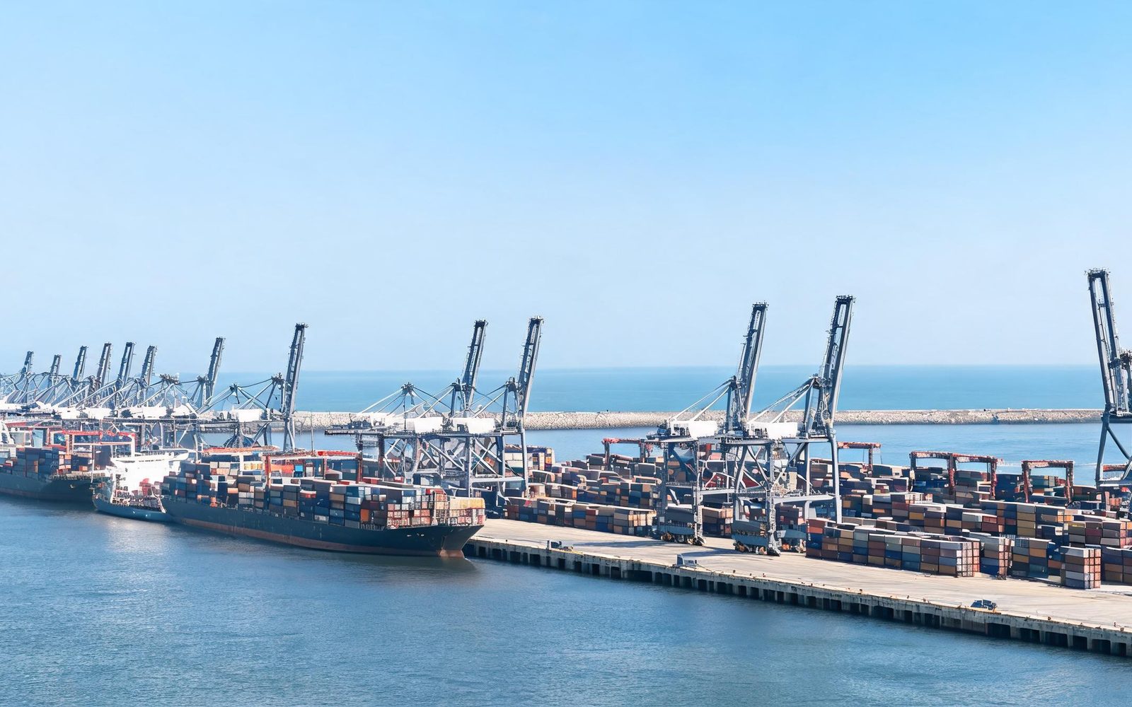
Maritime transport carries the overwhelming majority of world trade by volume; UNCTAD has noted that the figure exceeds eighty per cent. For a country whose energy, industrial inputs and consumer goods arrive by ship, the sea is not a backdrop to the economy but the mechanism through which it functions. Pakistan's imports and exports move through a small number of ports, and those ports connect to the world through an even smaller number of sea lanes.
What follows is a structural exposure. Distance matters less than concentration: a route that can be disrupted at one point affects the entire flow. This article sets out the routes Pakistan's trade uses, the chokepoints along them, and why the concentration is itself the strategic problem.
How Pakistan's trade reaches the sea
Pakistan's seaborne trade moves through its commercial ports, principally Karachi Port and Port Qasim, with Gwadar developed as an additional deep-water facility on the western coast. Together these gateways handle the containerised cargo, bulk commodities and fuels that the country imports or exports.
Each port sits at the end of an approach lane running from open water to the harbour entrance, shared with other traffic and affected by weather and the density of fishing vessels. Congestion or disruption at a single terminal propagates quickly through the supply chain, because storage and inland transport absorb shocks only imperfectly.
The Strait of Hormuz: the energy chokepoint
The Strait of Hormuz, the narrow passage between the Persian Gulf and the Gulf of Oman, is one of the most consequential energy transit points in the world. A substantial share of global crude oil and liquefied natural gas movements passes through it, so any interruption has effects far beyond the immediate region.
For Pakistan the strait sits on the energy supply chain rather than at the end of it: imported crude and refined products transit this passage. That dependency is a matter of geography, and the risks attached to the corridor are shared with every importing economy.
The Red Sea corridor and the Suez route
For cargo moving between Asia and Europe, the Red Sea route through Bab el-Mandeb and the Suez Canal is the shortest practical passage, and it has proved vulnerable. Attacks on shipping in the Red Sea resumed, with four fatalities confirmed in an attack on 11 August 2026, and earlier disruption showed how quickly operators divert around the Cape of Good Hope.
Diversion is rational and costly. Longer voyages absorb vessel capacity that is then unavailable elsewhere, raise fuel consumption, extend delivery times and tighten schedules across connected routes. Importers and exporters far from the disruption still pay for it through higher freight rates and reduced reliability.
The approach lanes and the wider Arabian Sea
Between the chokepoints and Pakistan's berths lie the approach lanes across the Arabian Sea, carrying a mix of transiting traffic, regional feeder services and fishing fleets. Their significance is easy to overlook because nothing dramatic happens there in ordinary conditions: the disruption that matters is often congestion, weather or a navigational incident rather than a deliberate act.
This is where monitoring pays for itself. Awareness of vessel positions, of anomalies in routing and of developing weather systems allows an operator or an authority to respond early. Where that awareness is incomplete, disruptions arrive as surprises and the response is reactive.
Why concentration, not distance, is the exposure
A long route is not automatically a fragile one. Fragility comes from lacking alternatives where the route narrows: a chokepoint matters in proportion to the traffic that must pass through it and the difficulty of going around it.
Pakistan's position combines two forms of concentration: a limited number of commercial ports handling national trade, and dependence on lanes that pass through established chokepoints. Neither can be dismantled quickly. Ports and their inland connections are long-term investments, and shipping routes are shaped by geography and economics no single country can reorder.
The risk layers acting on shipping
Risk to shipping is not a single phenomenon. Several distinct pressures can act on the same route at once, and they interact.
- Deliberate attacks on merchant shipping, verified by the International Maritime Organization in large numbers around the Strait of Hormuz since late February 2026, with at least 22 seafarers killed.
- Piracy and armed robbery at sea, where IMO figures show reported incidents worldwide rising from 146 in 2024 to 171 in 2025, an increase of 17 per cent.
- Rerouting and congestion, which convert a distant disruption into higher freight rates and longer transit times.
- Insurance and war-risk premiums, which rise with perceived exposure and are passed through to cargo owners.
- Navigational and environmental hazards, including adverse weather and traffic density in the approach lanes.
What diversification can and cannot change
Diversification is the standard answer to concentration, and it is a real one. Multiple ports, spare terminal capacity, alternative inland corridors and diversified energy sourcing all reduce the effect of a single failure. Each is a long-term programme with trade-offs in cost and in the distribution of benefits.
What diversification cannot change is geography. A strait remains a strait. The realistic objective is not to eliminate exposure but to understand it precisely: which flows depend on which corridors, how much slack exists, and how quickly a disruption can be absorbed.
Assessing the exposure honestly
Some things here are well established: the global reliance of maritime transport on a small number of transit points, the concentration of Pakistan's seaborne trade, and the incidence of attacks and piracy recorded by the IMO.
Other things are frequently asserted without adequate evidence. Precise figures for how much of Pakistan's trade passes through a given corridor, or for the cost of a specific disruption to the national economy, are not reliably available in the public domain, and quoted numbers should be checked against their source. The safer analytic position is to describe the dependency qualitatively and identify what data would be needed to measure it.
Frequently asked questions
- Why does a chokepoint matter more than the length of a route?
- A route's vulnerability depends on whether it can be bypassed. A chokepoint is a section that a large volume of traffic must use because no practical alternative exists for most cargo, so disruption there affects the whole flow.
- How exposed is Pakistan's energy supply to disruption at the Strait of Hormuz?
- The strait is a major global energy transit corridor between the Persian Gulf and the Gulf of Oman, and much of the world's oil and gas movement depends on it. The practical degree of exposure for any one country depends on its supplier mix, storage capacity and alternative arrangements, and should be assessed on that basis.
- What happens to shipping when a corridor becomes unsafe?
- Operators typically divert to longer routes, most often around the Cape of Good Hope for Asia–Europe traffic. Diversion extends voyage times, absorbs vessel capacity, raises fuel use and pushes freight rates up, with costs distributed across importers and exporters well beyond the disruption itself.
- Are piracy and attacks on shipping increasing?
- Reported incidents of piracy and armed robbery at sea worldwide rose 17 per cent between 2024 and 2025, from 146 to 171 incidents, according to the IMO. Separately, the IMO verified 80 attacks on international shipping in and around the Strait of Hormuz since late February 2026, with at least 22 seafarers killed.
Conclusion
Pakistan's maritime trade rests on a small number of ports connected to global markets through a small number of sea lanes. The Strait of Hormuz sits on the energy supply chain, the Red Sea corridor carries the Asia–Europe flow, and the approach lanes across the Arabian Sea link both to the national gateways. Each is a point where a disruption can travel further than its immediate location suggests.
The useful response to that structure is analytical before it is operational. Knowing which flows depend on which corridor, where slack exists, and what evidence would be needed to measure exposure is a precondition for sensible contingency planning.
PMRC works on maritime security and trade-route questions of this kind, examining how chokepoint risk propagates into national economies and supply chains. Institutions seeking independent research on shipping risk, maritime security or the resilience of trade corridors are invited to work with the Centre.